
DONNER LAKE RIM TRAIL
THE NEW TRAIL SEGMENT
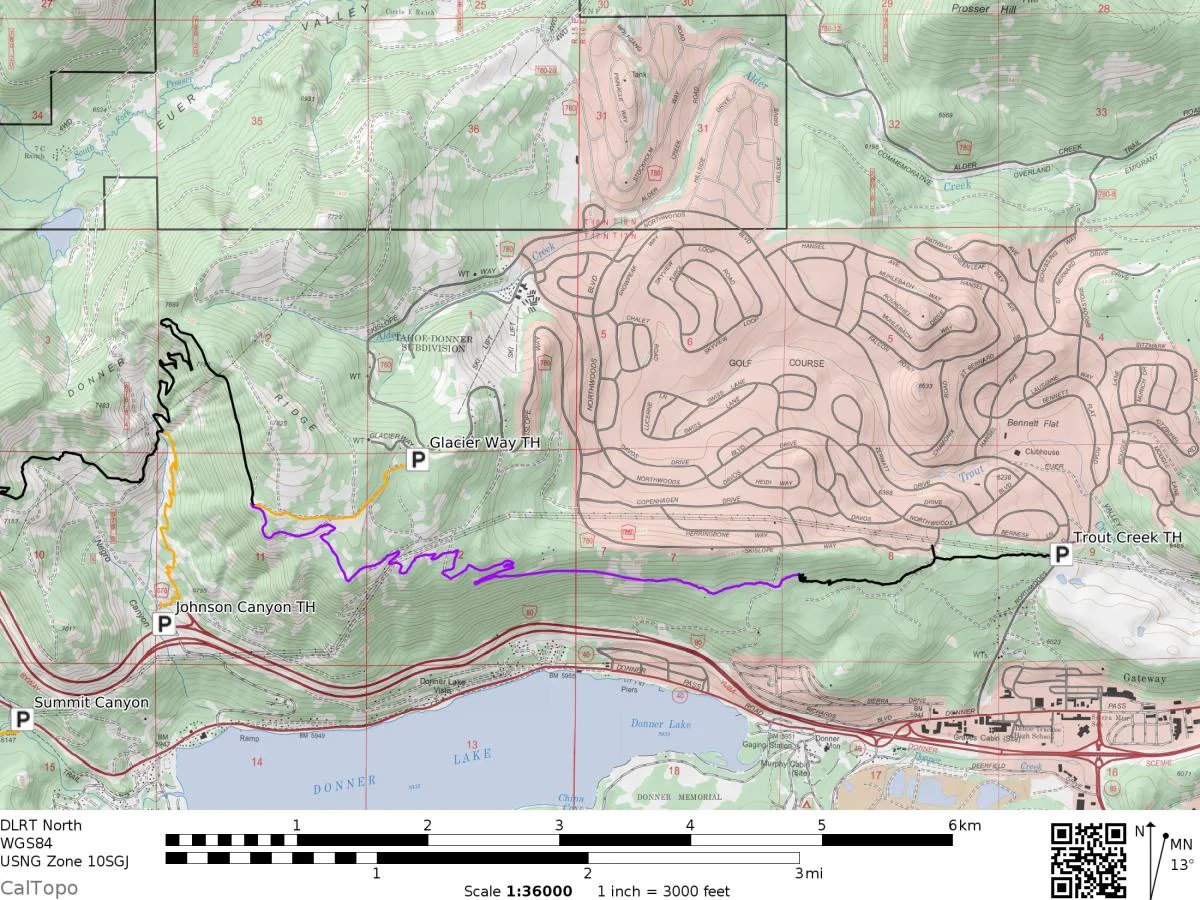
The Donner Lake Rim Trail is an in-progress trail project planned to encircle Donner Lake, along peaks and ridgelines, eventually adding up to 23 miles.
Current sections connect from Castle Valley on Donner Summit to Northwoods Boulevard in Truckee. Trailheads at Castle Valley, Glacier Way, Northwoods and a connection via the Wendin Way Trail offer a variety of access points. Ready to hit the trail? Click here.
A new section from the Glacier Way Trailhead to Northwoods Boulevard, about 4 miles long, was completed in 2019. The route contours the landscape below Skislope Way in Tahoe Donner, passing through mixed conifers, opening up to big views of Donner Peak, and passing by massive granite boulders left behind by glaciers. From here it will be possible to access Donner Summit from Downtown Truckee, all on trails.
Next up is the southern stretch along Schallenberger Ridge. Working with California State Parks, the US Forest Service and Placer County, 10 to 12 miles of trail are currently being studied by environmental specialists. This segment of trail will be shared with Placer County's Memorial Overland Immigrant Trail, offering even more options to explore.
Support the building of the DRLT by adopting a section of trail or volunteer to build a section.